
REFRAMING L-LINE DISTRUPTION
Brooklyn, NY
Critic: Bimal Mendis
Project Team Member: Jacob Shaffert
2018 SPRING
In October of 2012, Hurricane Sandy caught New York City flat-footed. One of the many pieces of infrastructure that were damaged by Sandy was the Canarsie tunnel, which allows the L train to connect Manhattan and Brooklyn. The MTA has determined that a full reconstruction of the tunnel will be required to make the line robust enough to withstand future storm events. The revamp is scheduled to begin in April of 2019, is anticipated to last for 18 months, and has set off speculation regarding the urban impact of suspending a resource that serves large population.
Our proposal reframes this disruption as an opportunity to develop the underutilized area in Brooklyn. We identified the sites along the Bay Ridge freight line intercepting L-line, which the community has a longer effect-affect relationship with. The empty space, abandoned warehouses, and the infrastructure along it become our site where we apply a subtractive design approach.
The freight line initially circumnavigated the city, however, through the early 20th century’s industrial expansion, easy access to rail shipping attracted numerous factories and heavy industries to East New York and Brownsville, much of which is evidenced by vestigial industrial zoning and abandoned infrastructure along the rail corridor. Large concentrations of these vacant facilities are in Brownsville, Canarsie, East Flatbush, East New York, and the Army Terminal. Even in more affluent neighborhoods, the immediate proximity of the rail is dotted with vacant lots, factory spaces, and other unused infrastructure.
Concurrent with the L-Line closure and the ongoing issues in East Brooklyn, the construction and housing boom has breathed new life into the Bay Ridge Branch Line. Environmental and feasibility studies have gone into advanced stages for a planned tunnel between New Jersey and Brooklyn. This tunnel will be freight exclusive and has been in the works since the founding of the Port Authority in 1921 as part of its original charter. The current system for transporting freight cars across New York Harbor, which has been in place as a temporary stop-gap measure for the past century, is a series of barges called “car floats.” These barges require trains to decouple and drastically limit both the length and the number of cars crossing to Long Island. This increases the dependency on truck transport, compounding congestion on the already crowded city highways and aging bridge system.
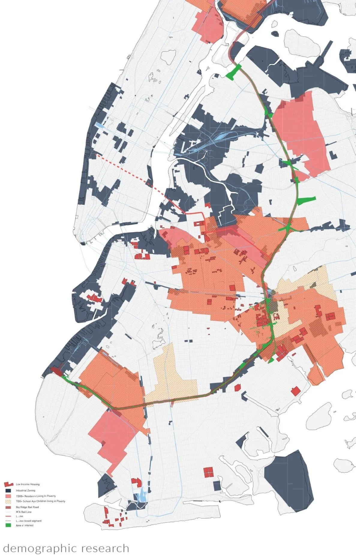
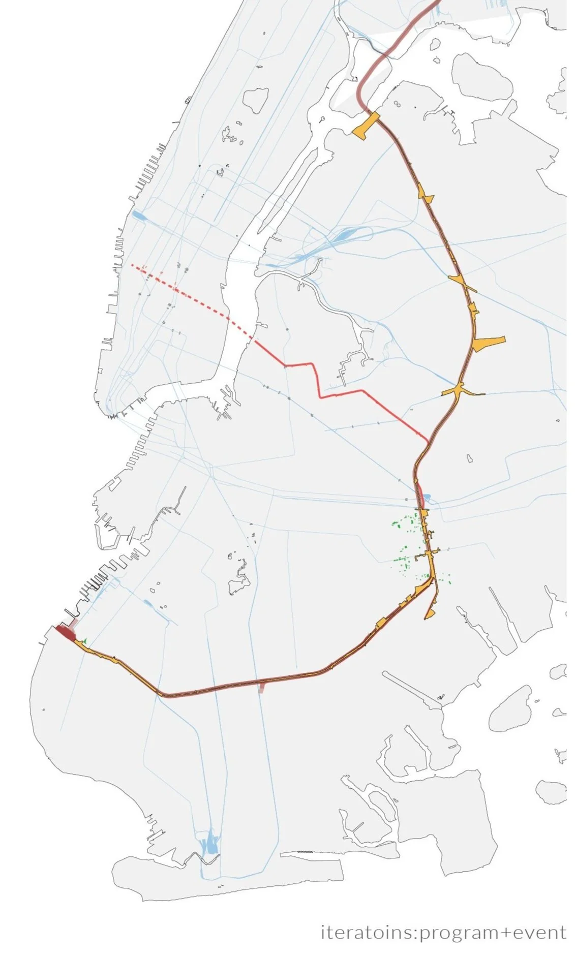
We see the rail expansion as a massive opportunity to engage in community investment in a series of historically under-served neighborhoods, develop under-utilized properties, and engage in a non-Manhattan centered urban plan. We call this strategy Rail +. By this, we mean to target sites along the Bay Ridge Line as it undergoes modernization and expansion, allowing the communities it cuts across the to prosper from the increased development. This will allow the freight line to run to instead of run through these neighborhoods. This strategy involves targeted developments to create centers for rail based commerce, modern and high-end precision fabrication facilities, and cultural sites coupled with a development of the edge condition to ameliorate the ill effects of increased train traffic.
Case study Brownsville
RAIL+
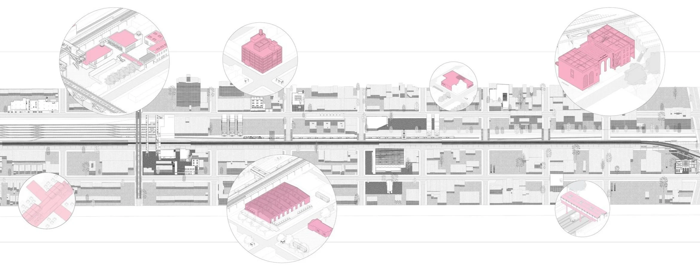
As a test of our Rail + strategy we examined the Brownsville rail corridor as a case study. Using the rail easement as a linking element tying together targeted sites, Rail + forms a necklace and bead strategy. We feel this site, with its concentration of post-industrial lots, a neighborhood historically under-served by the city, as well as a community with historic ties to rail-based industries.
-
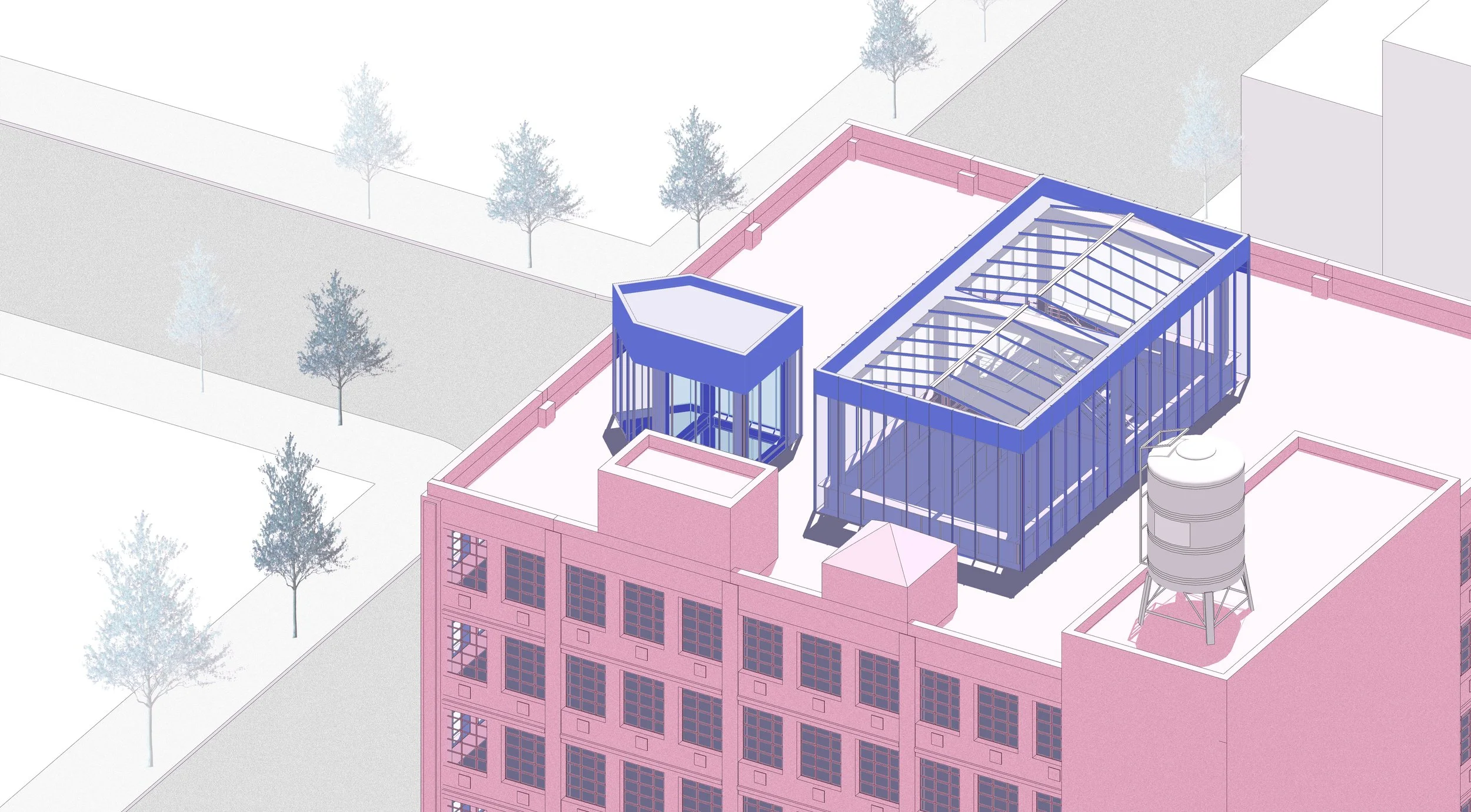
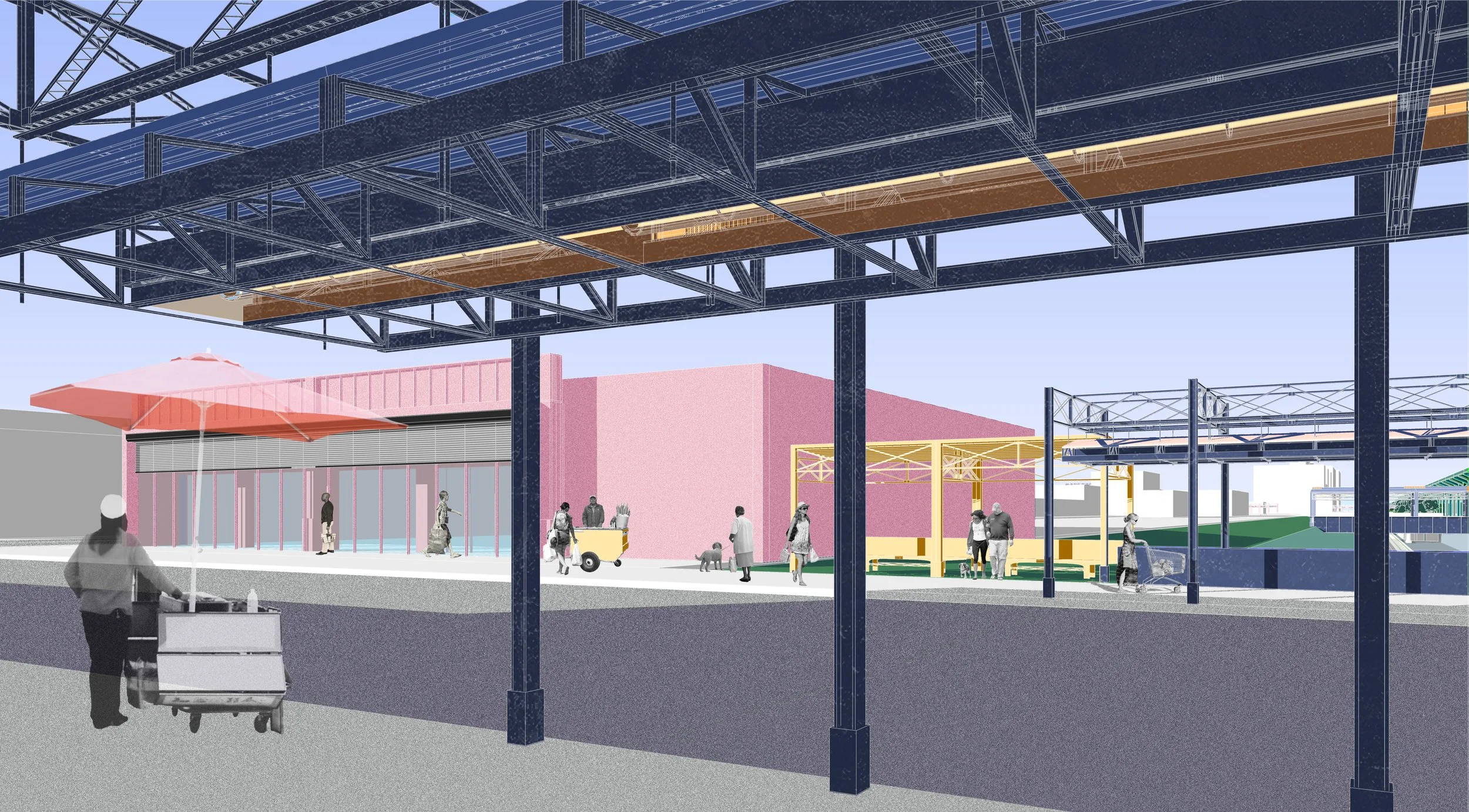
Our first target intervention is a shuttered factory complex adjacent to a drug rehab clinic and the former Linden Rail Yards. We propose renovating the factory complex into a technical school that can provide skills and job training to patients at the clinic, who are commonly in need of job skills and training, as well as the community at large. Technical schools offer a set of skills and training that would, in a short amount of time, allow previously under employed and minimum wage workers to pursue higher paying, higher skilled work. We have renovated the adjacent warehouse into an intermodal freight hub, providing jobs and access to rail commerce.
-
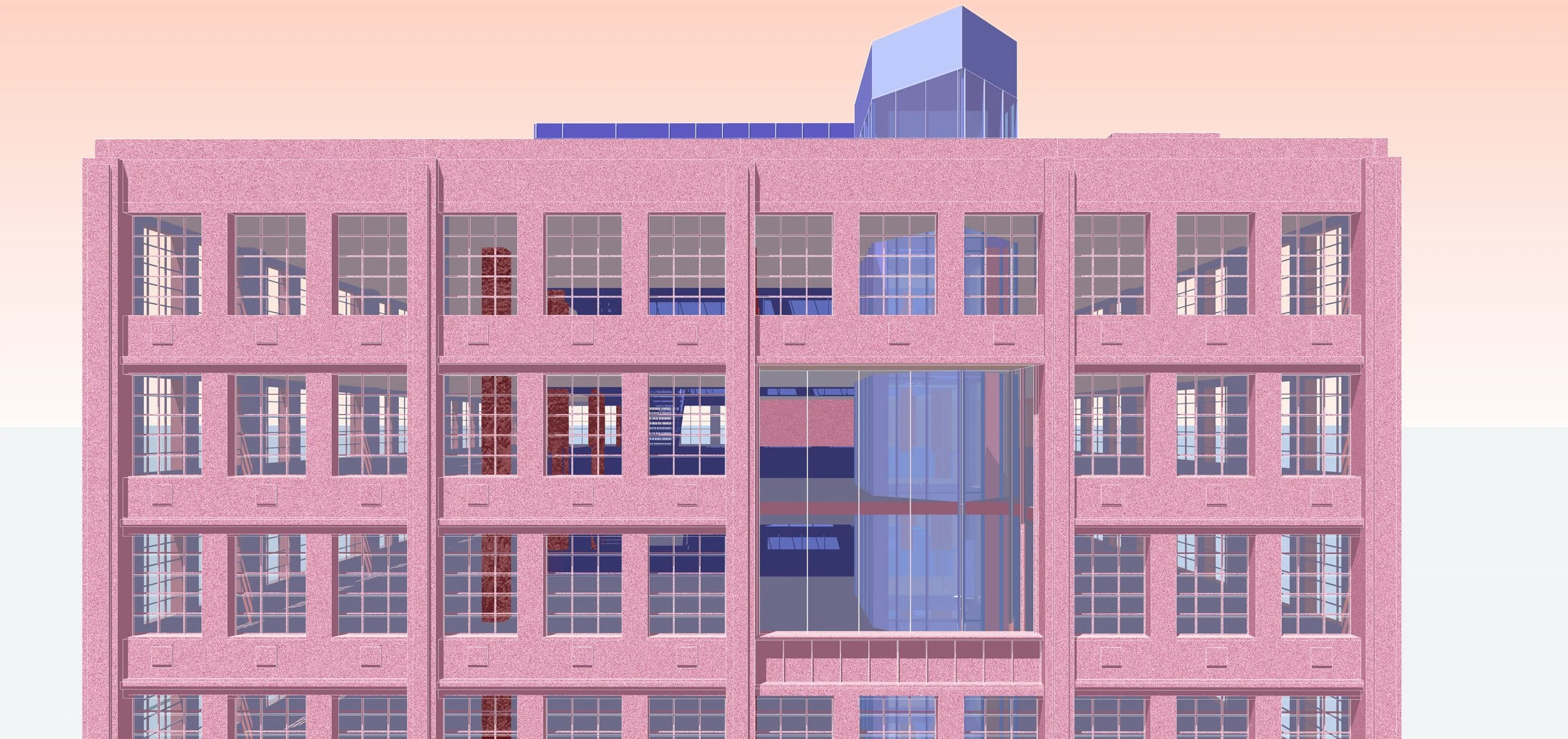
Located at Junius and Blake St., the 1920s era garment factory building used to house Helping Hands Ministry and homeless shelter in the 1990s before it was condemned by the city government. We renovated the building and near-by abandoned 1930s era factory to create a business incubator, rentable office space, and workshop facilities for fledgling businesses. Easily accessible and affordable space to start a business and space for the supporting services is vital in nurturing a rail powered renaissance of Brownsville. The incubator space would cater to both industrial fabrication as well as more white collar start-ups to allow a variety of different business ventures.
-
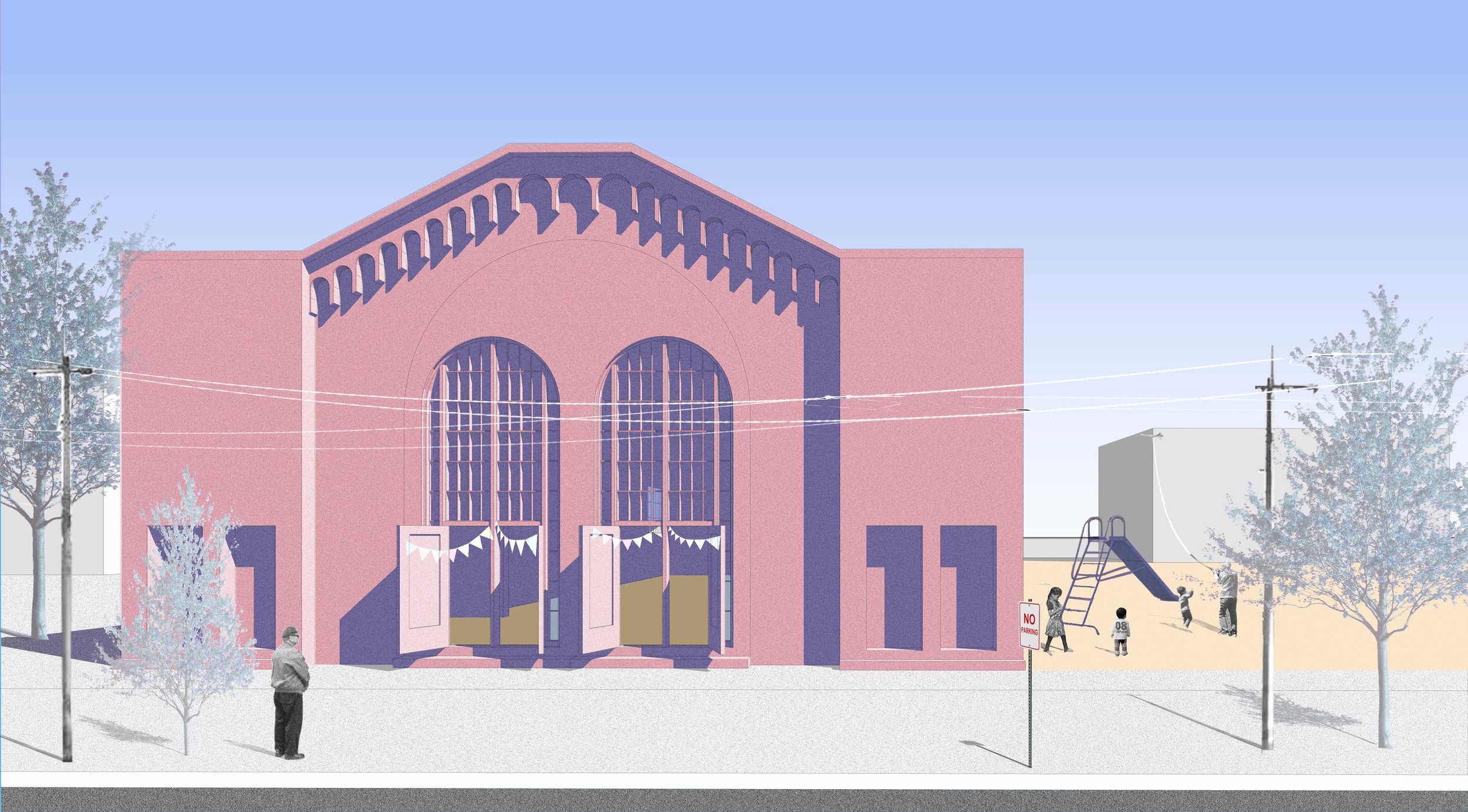
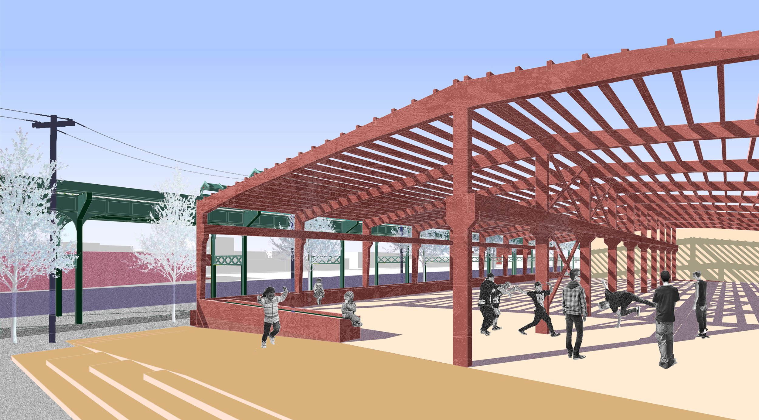
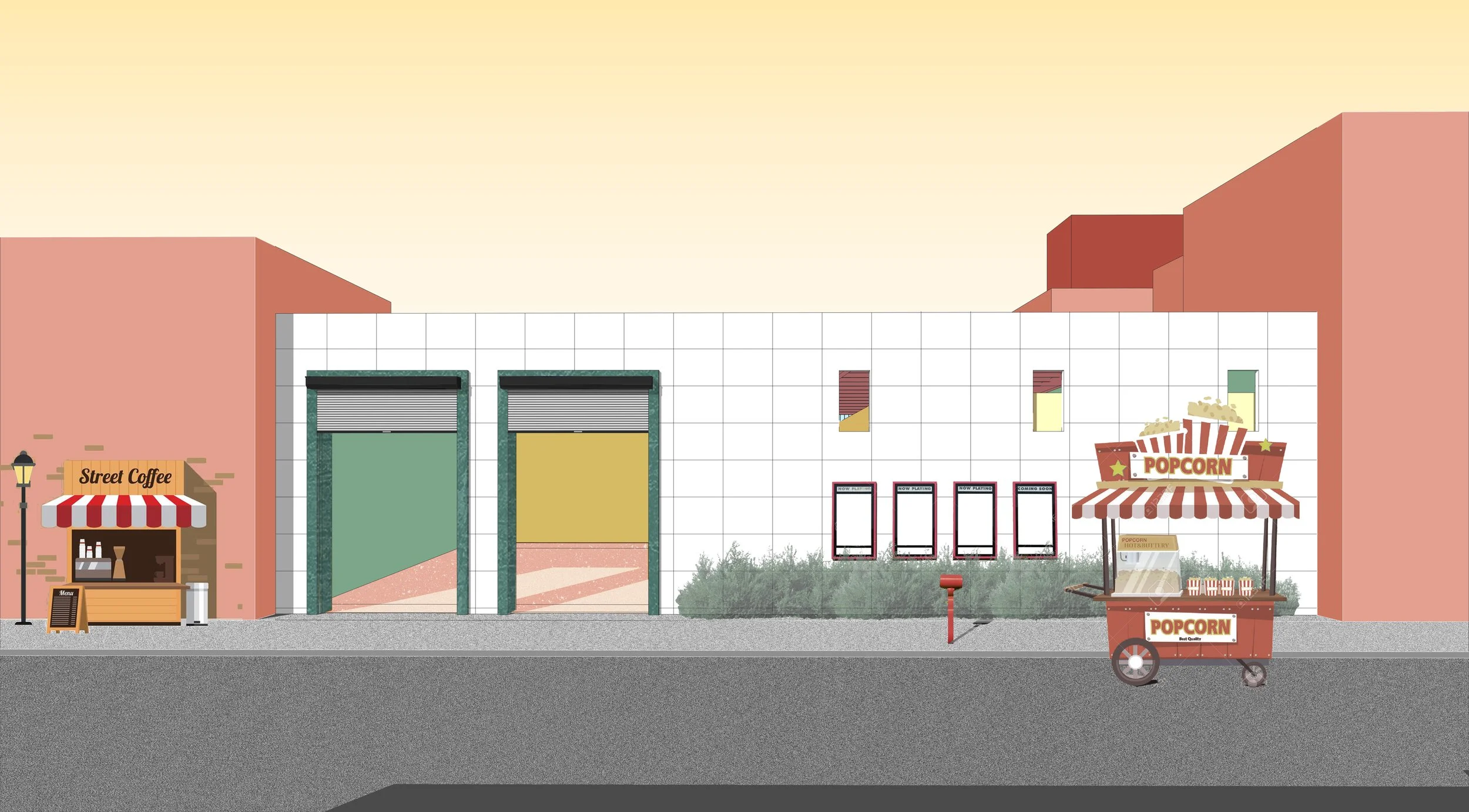
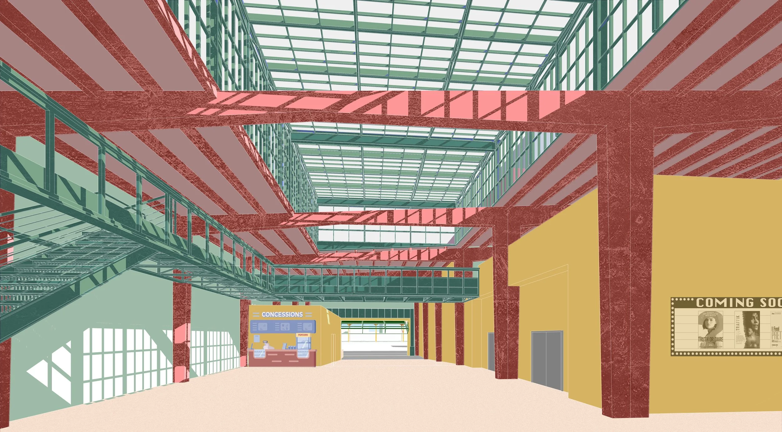
Brownsville, in the early part of the 20th century, had two famous theaters that have since closed, leaving the neighborhood without dedicated space for local arts programs, theater troupes, or live entertainment. We renovated a condemned warehouse that conveniently has 3 different street frontages off of Junius and Pitkin as a flexible theater space. Beyond providing facilities for industrial training and economic activity, fostering a rebirth of community civic and art space is vital for maintaining community identity through probable gentrifying developments that will be built up around the expanded rail and renovated L Line corridor.
-
Off of the Sutter L-Line station is an under occupied warehouse, a former supermarket-turned Metro PCS store, and a boarded-up 1923 historic Jewish Synagogue. The warehouse has been stripped of its exterior and transformed into an out-door gathering space. We connected it using a footbridge a renovated and reopened supermarket. Currently, each housing complex has its own small outdoor spaces for community gatherings, however, there isn’t a dedicated space that can accommodate the larger neighborhood population. This warehouse and the adjacent buildings are located center of the rail corridor that cuts between Brownsville and East New York. We are turning this divide from a split between communities to a nexus of gathering and bridging between both neighborhoods.
-
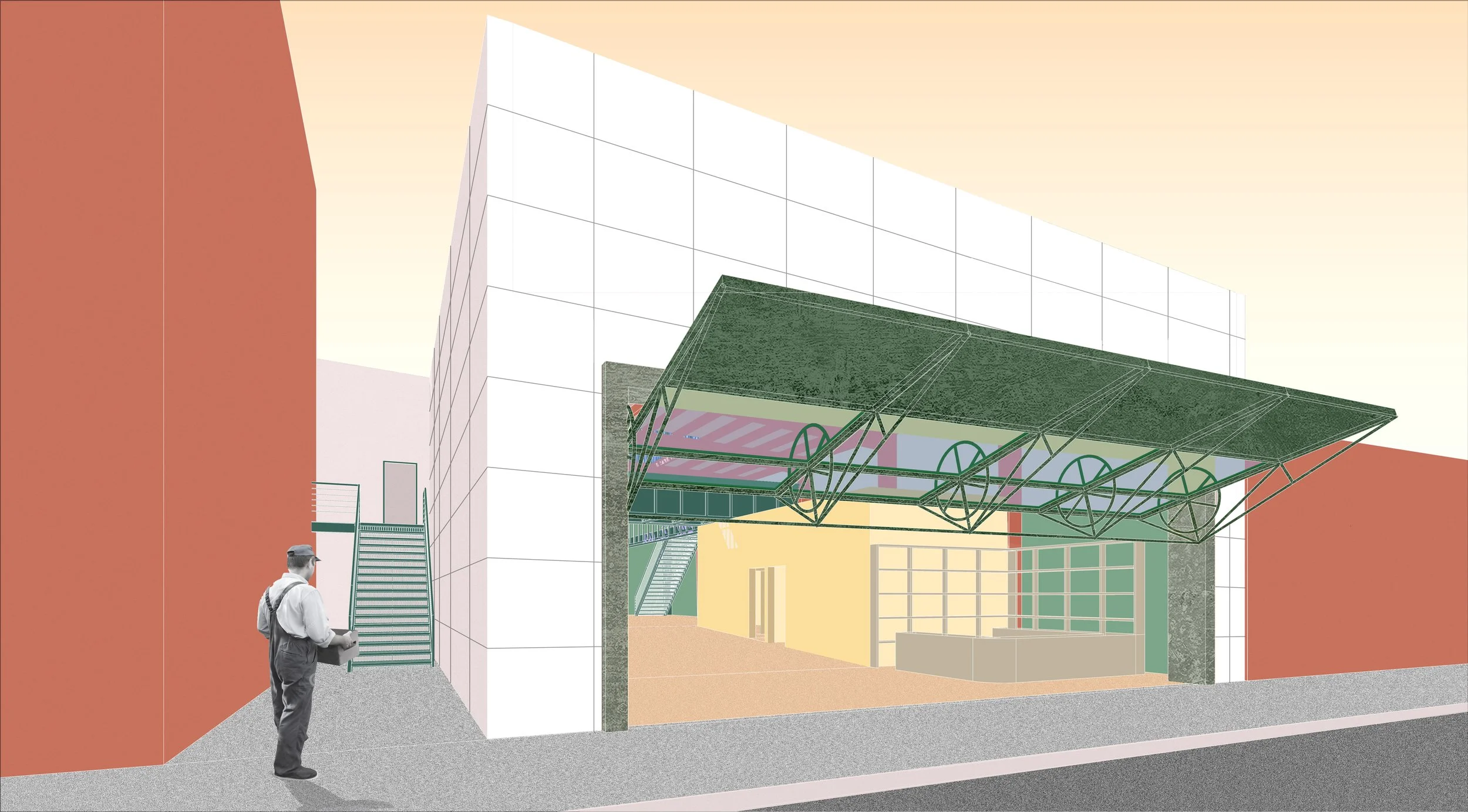
At the Atlantic Avenue Tunnel and adjacent to the L station is the abandoned Long Island Rail Road Substation 2. Built in 1905, it is one of the oldest standing buildings in the neighborhood. We renovated the building, turning it into a museum that celebrates the rich cultural history of the neighborhood, community achievement, and documents the connection to rail and industry.
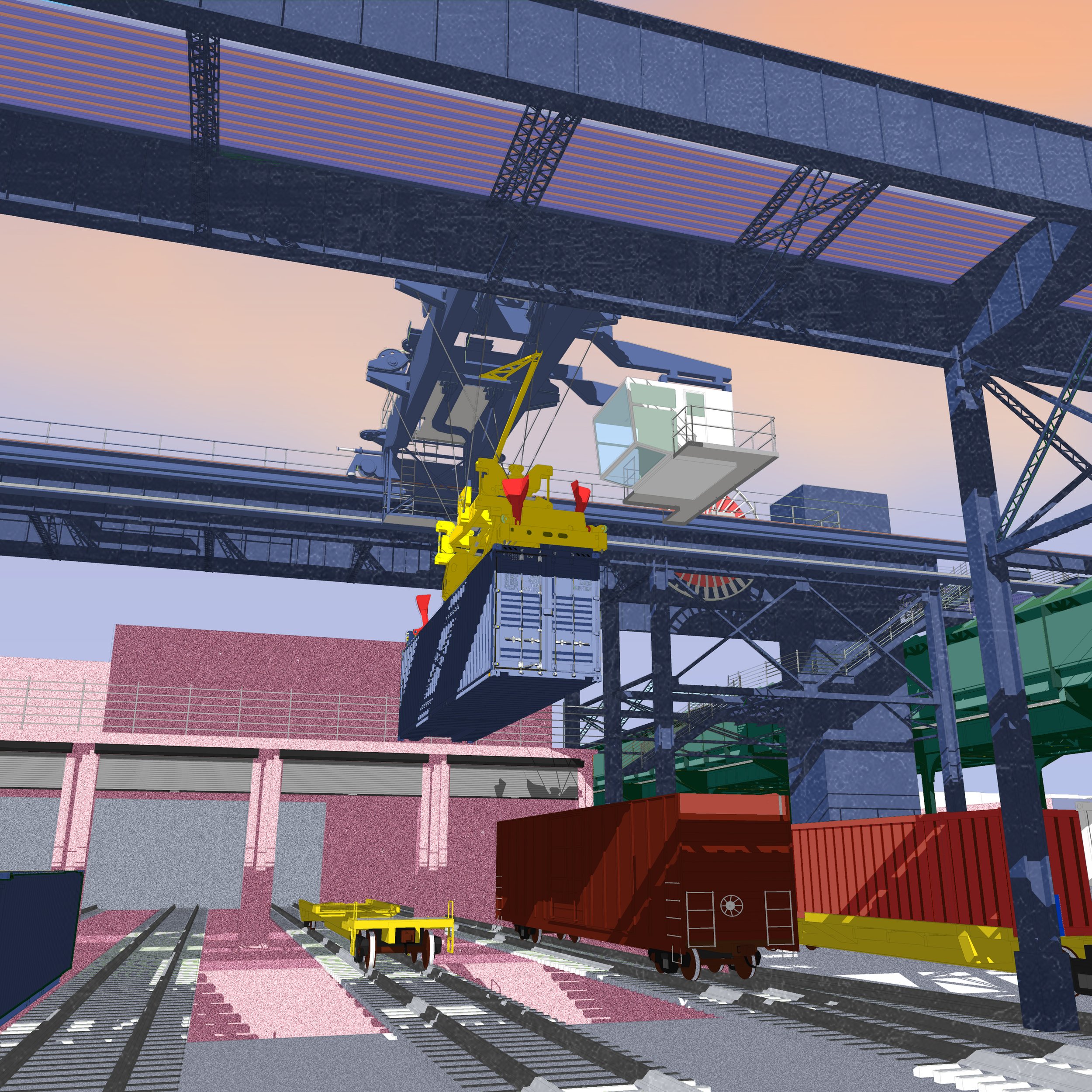
The vocational school is adjacent to a reinvigorated Linden Yards and intermodal rail shipping center. A pedestrian walkway along the edge of the gantry connects the Brownsville neighborhood, over the rail yards, to the East New York side of the tracks. We have additionally provided elevators and direct linkages to the Livonia L-Line and Julius 3-Line stations along this bridge for greater accessibility.
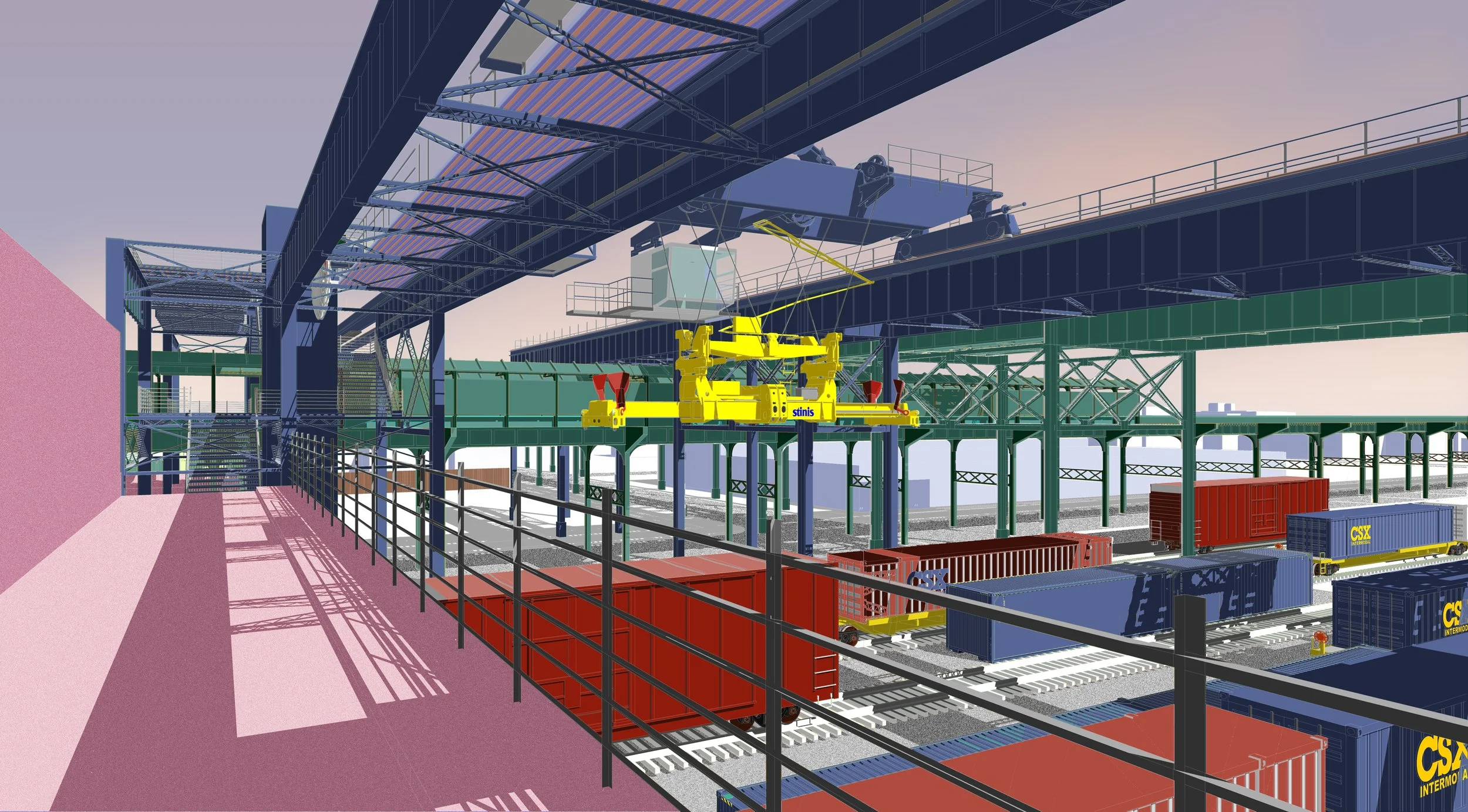
Vocational School from Shipping Center
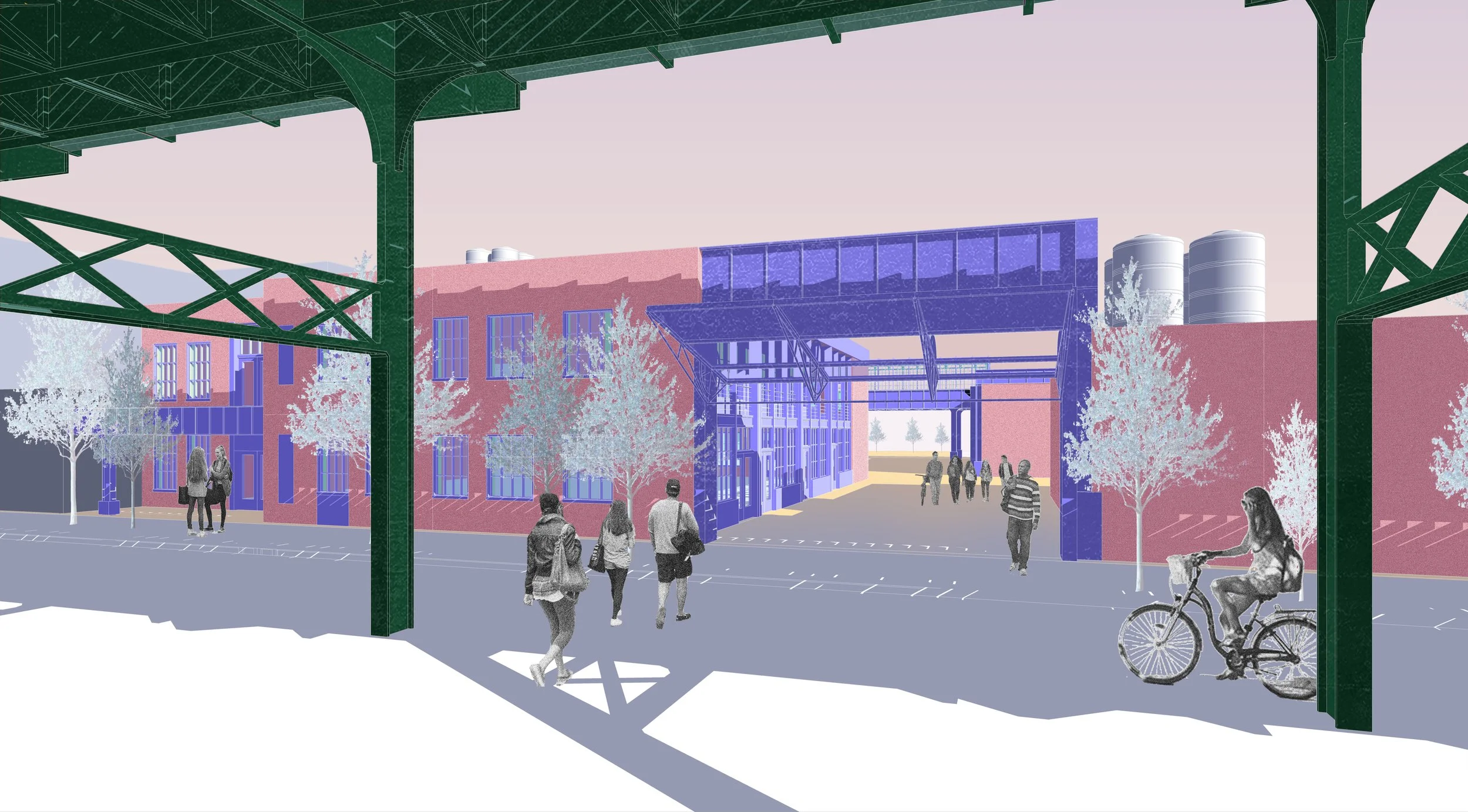
Vocational School Entrance
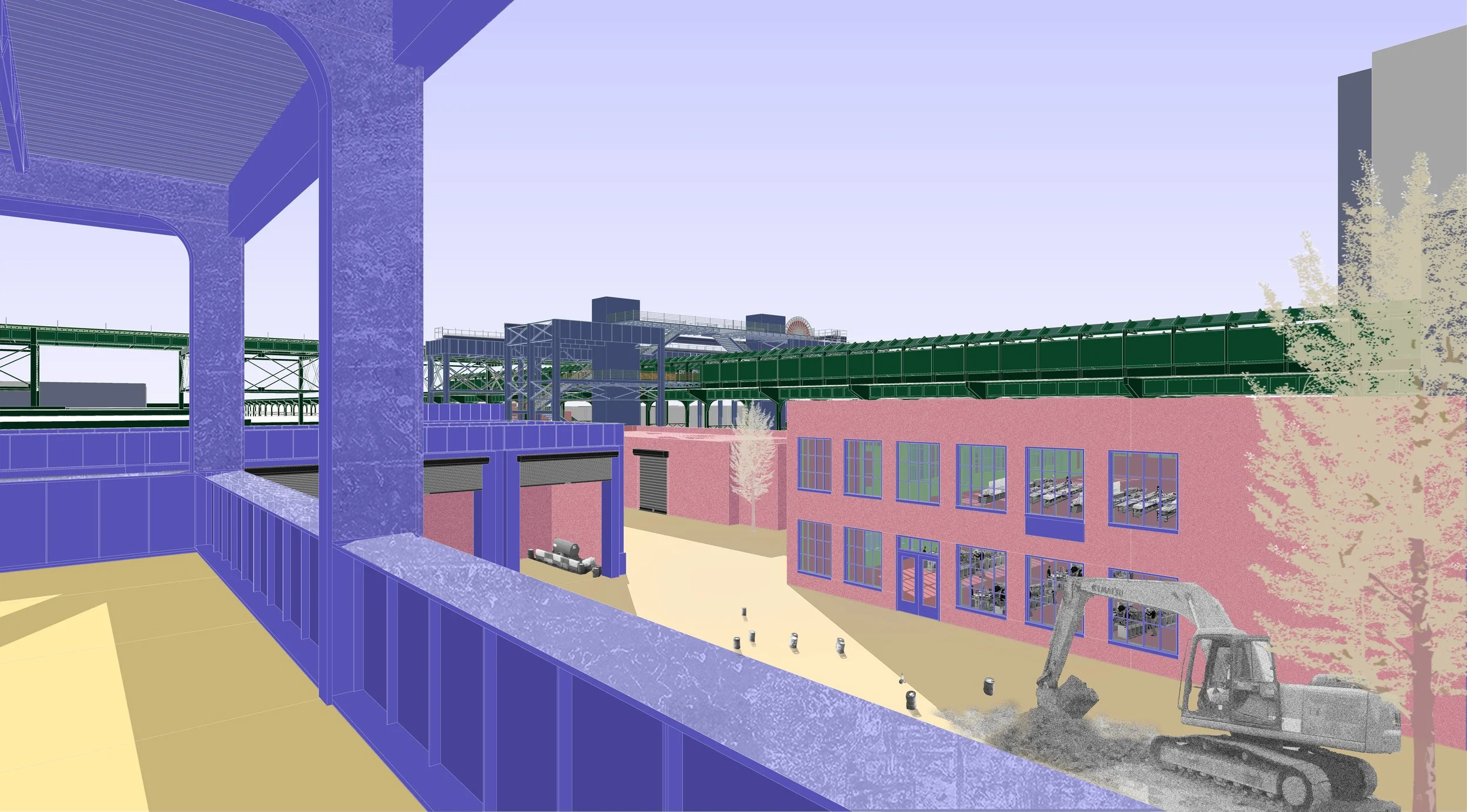
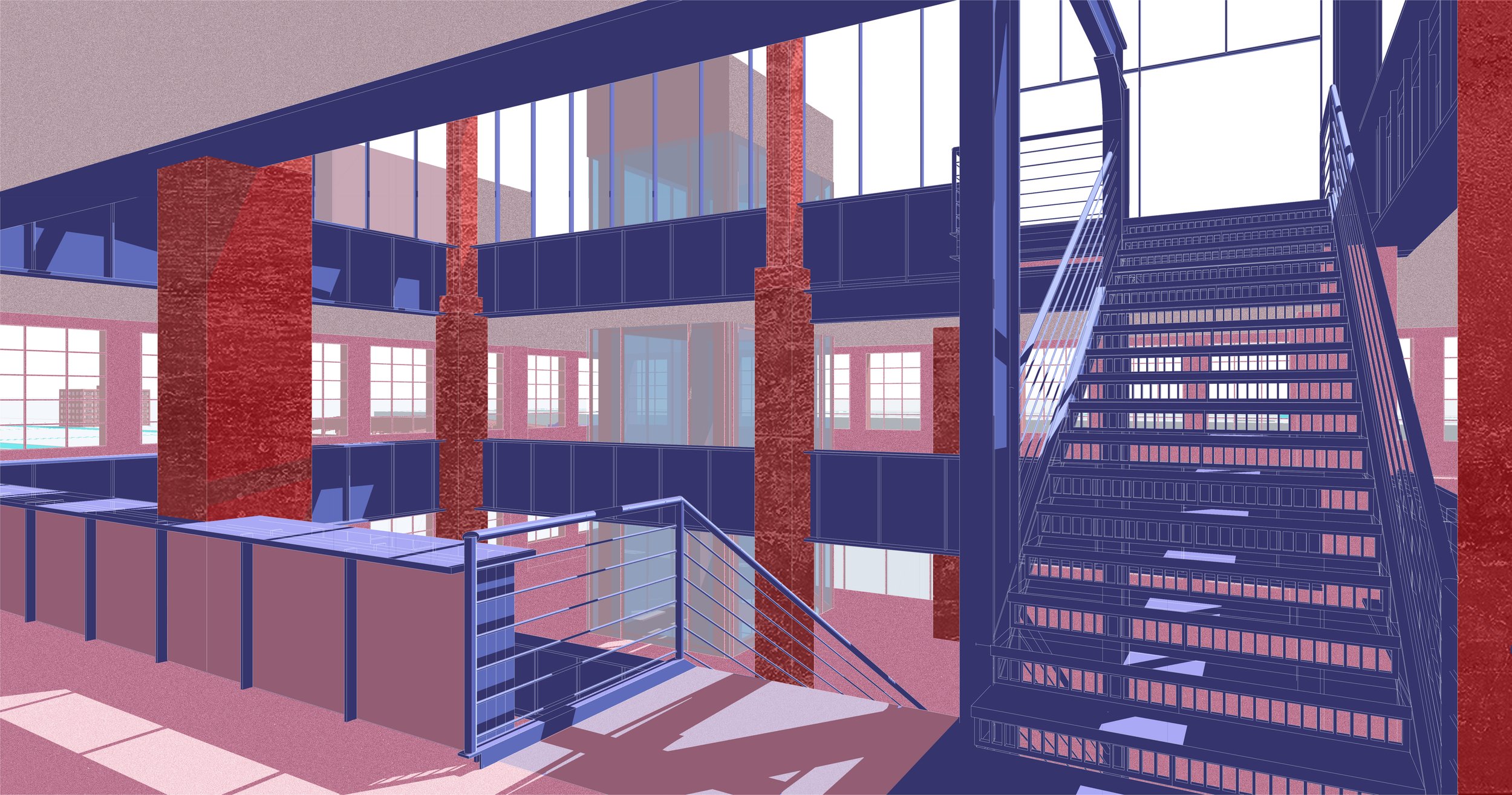
Vocational School Facilities
Garment Factory Façade Restored
Garment Factory Roof Restored
Garment Factory Interior
Farmer's Market
Synagogue
Warehouse Dancing Hall
Theater Entrance
Theater Entrance
Theater Interior
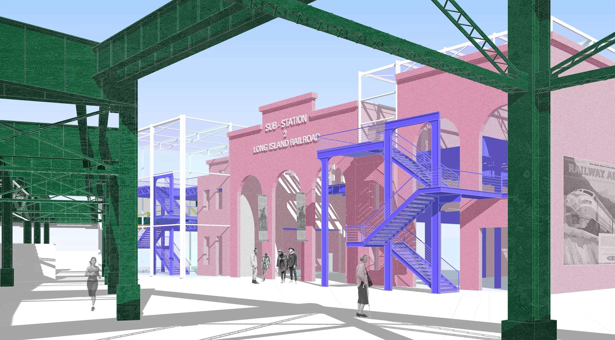
LIRR Museum Approach
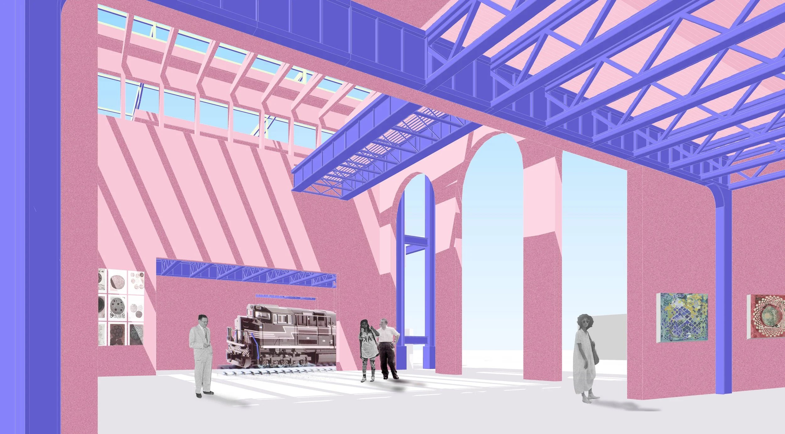
LIRR Museum Interior
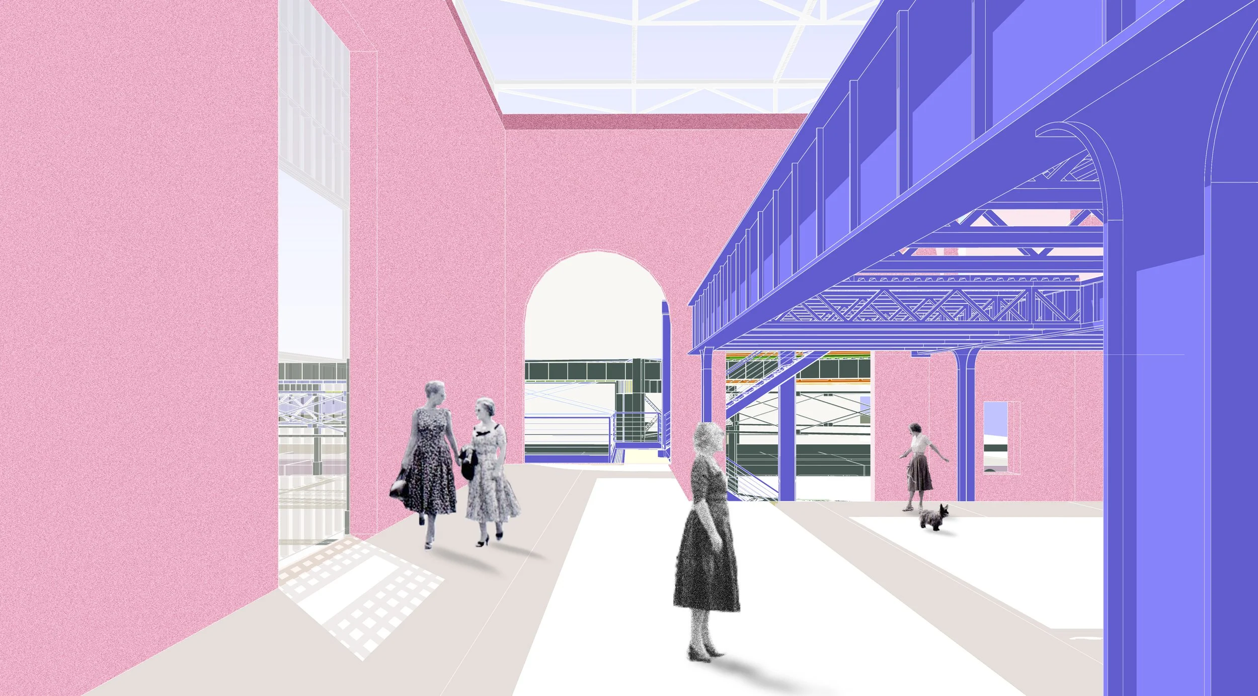
LIRR Museum Rooftop Exhibition